
North Royalton Street Directory Walkthrough
Work one property at a time. In Cuyahoga County, the most dependable starting point is an address in Cuyahoga County MyPlace, not a broad name list. Select North Royalton in the City control when it helps, choose Address, and open the matching parcel. The property card can lead to the parcel identifier, situs address, mailing address, transfers, map, tax history, and recorded-document list. It identifies a land interest and a record trail. It does not establish a complete household.
- Enter the current address in MyPlace and select the parcel that matches the physical location.
- Save the parcel ID, situs address, legal description, transfer details, and the date of the search.
- Use the map only to understand parcel geography, then verify ownership details with the source office.
- Open the recorded-document lead and compare the parcel or legal description with the deed instrument.
- For an older address question, move to tax maps, atlases, or a criss-cross volume that covers the needed period.
Each step narrows the record question. A person named on a deed, tax bill, permit application, or directory entry has a different relationship to the address. Keep that relationship and source date with the note instead of combining unlike records into a claim about a household.
MyPlace Fields for North Royalton Addresses
County Treasury instructions for MyPlace confirm the three starting search paths: address, owner name, and parcel number. Address is the useful path for a street question. City is an optional countywide filter, while Search By must be set to Owner, Parcel, or Address. A selected parcel then offers General Information, Transfers, Values, Land, Building Information, Building Sketch, Other Improvements, Permits, Property Summary Report, Tax By Year, and a document-list link.
The following Cuyahoga property-tax search instructions show the county's entry point for an address, owner, or parcel search.
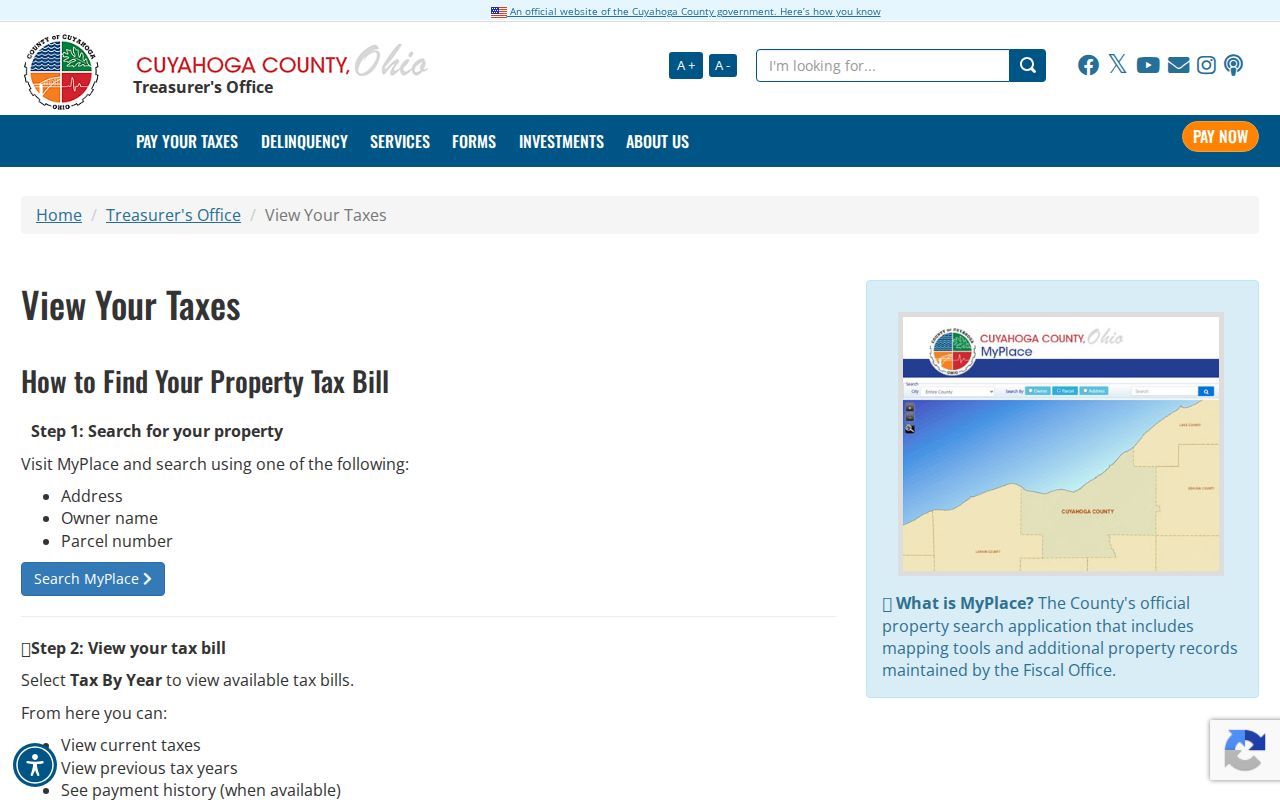
Use the resulting card as a locator. MyPlace states that its geographic and analytical display is a public-service convenience, so an actual recorded instrument or the responsible Fiscal Officer record controls when a detail matters.
| MyPlace field or tab | Use for an address search | Limit to keep |
|---|---|---|
| City | Select North Royalton to narrow the countywide search. | It is a search filter, not a postal or legal boundary. |
| Search By | Choose Address for a physical property, Owner for a known interest holder, or Parcel for an identifier. | Do not substitute one mode's result for another fact. |
| General Information | Check the property and parcel context. | Recheck formal details with the custodian if needed. |
| Transfers | Find prior transfer leads and dates. | A transfer entry is not a full title opinion. |
| Tax By Year | Reach the current or prior tax-bill route after finding the property. | Tax correspondence data is not a residence confirmation. |
| Get a Document List | Move from the parcel toward recorded legal documents. | Read the actual instrument before drawing a conclusion. |
Note: MyPlace can locate a North Royalton parcel, but the Fiscal Officer and recorded instrument control any title or ownership conclusion.
North Royalton Address Record Coverage
Address-keyed sources do not all cover the same period or question. The County's current portal is useful for a parcel and transfer lead. The Recorder supplies the recorded legal trail. Archives materials supply the older tax and map layers. City material can supply a defined project or decision file. Reading the source label first prevents a property record from being mistaken for a directory of people.
| Address record | Keeper | What it can establish | Access channel |
|---|---|---|---|
| Property card | Cuyahoga County MyPlace | Parcel, property and mailing addresses, ownership history, transfers, land and building data. | Online Address, Owner, or Parcel search. |
| Recorded document | Cuyahoga Recorded Document Search | Party, date, document type or number, parcel, and legal-description trail. | Web index, Recorder counter, or free public-record request. |
| Tax record | Cuyahoga County Archives | Historical tax duplicates and valuation change clues. | Archives for 1819 through 1986; online or phone route for later tax material. |
| Map or atlas | Cuyahoga County Archives | Historic owner labels, road and lot geography, and building-outline context. | Appointment-only property research and reading-room materials. |
| Parcel map | North Royalton Online Community GIS | Parcel geography, zoning layers, and a MyPlace handoff. | Address or undashed-parcel search, click and zoom. |
| Building or BZA file | North Royalton Building Division | Defined project, application, plan, or hearing evidence. | Office, posted materials, or a focused city-record request. |
For a single address, the chain is deliberate: find the parcel, compare the map context, use the parcel or legal description in recorded documents, and then add archival or city material only when the question calls for it. The county warns against automated extraction in the Recorder system. Review a small number of relevant parcels individually.
| Step | Record path | Practical result |
|---|---|---|
| 1 | MyPlace City plus Address | Selected parcel, property context, and transfer lead. |
| 2 | Map or city GIS | Parcel geography, not official title. |
| 3 | Recorded Document Search | Deed or other instrument through party, parcel, legal description, number, or date. |
| 4 | Archives tax maps and atlases | Older owner, map, and valuation chronology where coverage exists. |
| 5 | Building Division or BZA file | A defined project or city-decision record, subject to access limits. |
| 6 | Library criss-cross volume | A historic listed name at an address, with publication-coverage limits. |
Note: A small, parcel-by-parcel record trail is more reliable than treating a street result as a household list.
North Royalton Address Terms
Several labels can appear beside the same North Royalton parcel. They should not be treated as interchangeable. The short definitions below keep the property, postal, and historical evidence in separate lanes.
- Parcel
- A county property identifier that links a selected tract to property, tax, map, and recorded-document leads.
- Situs address
- The physical location of the land or structure shown in property and GIS work.
- Mailing address
- The correspondence destination used for the tax bill. It can be elsewhere and is not proof that a named person is at the property.
- Legal description
- The land description used in deeds, plats, subdivisions, or lots. It can bridge changing address language.
- Criss-cross directory
- An address-first directory arrangement that may show a historic listed name only when the published volume covers the place and year.
The parcel number has a documented format of eight digits, usually shown as 000-00-000. The city GIS accepts the number without dashes, while the Recorder instructs users to include dashes. That small difference is worth recording in an address research log.
North Royalton Street Directory Deed Trail
Cuyahoga Recorded Document Search is the legal-record step after a parcel has been selected. The county states that its recorded-document coverage reaches from 1810 to the present. Search by grantor or grantee, subdivision, document type, document number, parcel, legal description, or recorded-date range. The quick screen also distinguishes an index search from an index-and-full-text OCR search. OCR is a finding aid, not a substitute for reading the document.
The following Recorded Documents office image is the county source for the deed and filing route.
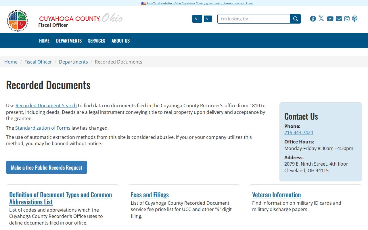
From a current transfer, locate the acquiring party as grantee and note the instrument date and number. To move back, search the prior grantor as an earlier grantee. A trust, estate, company name, release, or spelling variant can break a simple name chain, so retain the parcel and legal description. The Recorder counter at 2079 East Ninth Street in Cleveland and its free public-record request route remain available when a web query is incomplete.
Note: Record the document number and date before moving backward, because a surname alone can connect several unrelated instruments.
North Royalton Building Files
North Royalton Building Division provides an address-keyed city trail for construction, renovation, enforcement, inspection, and planning matters. A plan-review application can contain a project address, parcel, scope, site material, and the names of parties connected with the application. No broad public index for every permit was verified. For a defined file, contact the division at 11545 Royalton Road or 440-582-3000, check posted BZA or Planning material, or use the city's public-record path.
A useful request identifies the property address, approximate project or date range, and a particular record series. The North Royalton Public Record Policy says a requester does not need special wording, a written request, an identity, or a reason for an existing record. It also explains that the city need not create a new analysis. Narrow requests are therefore more likely to reach the right permit, plan, council, or BZA file without asking staff to assemble a person list.
Record boundary. City code places a proprietary-interest condition on access to applications and certificates connected with occupancy, so do not treat those records as a general address directory.
North Royalton GIS Parcel Checks
North Royalton Online Community GIS is the city map complement to county property data. Its documented search bar accepts an address or an undashed parcel number. Turn on the parcel layer, click the property, and use the popup's MyPlace handoff for the detailed county record. The GIS is valuable for placing a property on the map, but it is not an official title source.
| GIS control | Address use | Important convention |
|---|---|---|
| Search bar | Locate an address or parcel on the city map. | Enter parcel numbers without dashes. |
| Layer List | Turn parcels on to see parcel information. | Several enabled layers can create several popup pages. |
| Parcel popup | Review a clicked property's map information. | Use the blue-tab arrows when layers supply more than one page. |
| Info or MyPlace link | Hand off to the county property detail. | Use the county record for parcel facts. |
| Measurement | Measure distance or area on the map. | It describes geometry only, not people. |
Map context is especially useful when a street spelling differs across records. Do not infer an unverified street-renumbering event from a map mismatch. No citywide renumbering date was documented in the research.
Note: City GIS supplies map context, while MyPlace and the Recorder remain the documented verification channels for parcel and deed facts.
North Royalton Historic Address Keys
North Royalton was known as Royalton Township before the 1881 name change. That is a research control, not a decorative history note. A deed, atlas, tax duplicate, directory, or cemetery reference may be cataloged under Royalton or North Royalton and may use a road, lot, section, or rural description instead of a current number. York and State Roads are early routes in the historical geography. If a modern search fails, keep the parcel, legal description, old road spelling, and place name together.
The Cuyahoga County Archives property-research service is the documented route for the older layers.
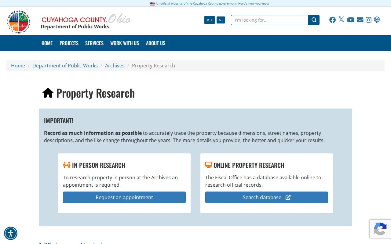
Property research at the Archives is by appointment. Bring at least a street address or parcel number. The collection includes tax records from 1819 through 1986, county atlases from 1852, 1874, 1892, and 1903, and tax maps from 1860, 1870, 1880, and 1890. Building outlines can show that a structure stood in a mapped year, while tax duplicates can add an ownership or valuation clue. For the library shelf and its uneven criss-cross coverage, use the North Royalton Directory Book.
North Royalton Voter Boundaries
Ohio My Voter Information is an individual confirmation tool. It requires first name, last name, and county, with a street-name selector only after an initial narrowing step. Select Cuyahoga for a North Royalton question. The public-facing tool can help someone check registration, precinct, and polling information, but research did not identify a North Royalton street-wide voter browser. Do not turn its conditional street control into a roster method.
For historic civic research, Cuyahoga County Archives holds Lists of Electors from 1893 through 1982, Abstract of Votes from 1893 through 1974, and an Index to Naturalized Voters around 1865 through 1975. Those are historical electoral materials, not household evidence. Current voter records also exclude protected addresses and personal contact or identifier fields under Ohio law.
Note: Voter tools support a lawful individual confirmation, not a current street roster or a conclusion about every nearby household.
North Royalton Address Limits
A property card names an interest holder and may show a tax mailing address. It does not settle who is physically present at the property. A city permit or a historic directory entry has its own narrower purpose and date. Utility accounts, driver records, and protected voter information are not part of a normal address search. An absent result can reflect a coverage gap, a different record type, a protected entry, or a changed name rather than the absence of a local connection.
Lawful use. Use address records for personal, historical, estate, civic, or safety questions only; never stalk, harass, harm, impersonate, or expose protected data.
Ohio Public Records Act access does not require a public office to create a new street-wide analysis. Ask the proper custodian for an existing, defined record and verify important information with that office.